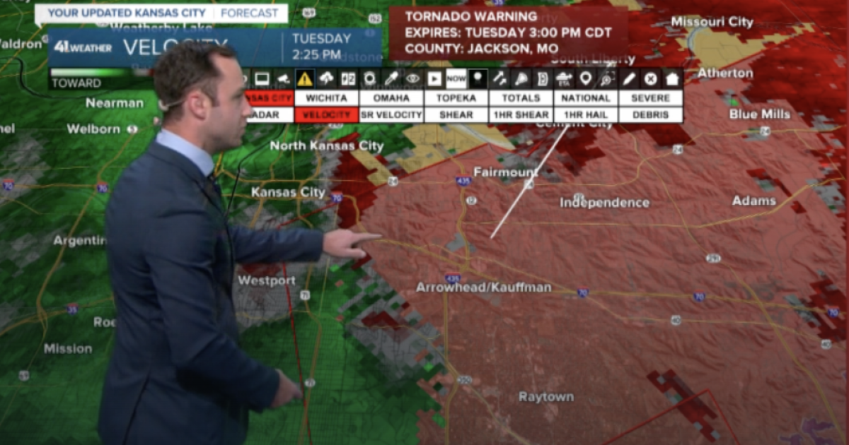
On this soggy Tuesday, residents of parts of Kansas City are urged to stay vigilant as severe weather looms over the region. The National Weather Service has issued a tornado watch for various areas, including segments of Cass, Jackson, and Johnson counties, effective until 8 p.m. this evening. As thunderstorms roll in, the forecast indicates the likelihood of severe weather, prompting safety precautions for those in the affected areas.
In addition to the tornado watch, the region is also under a flood watch that will remain in effect until Wednesday morning. Heavy rain and strong storm systems threaten the possibility of flooding, particularly in low-lying areas. Residents are encouraged to stay informed, and regularly check updates from local weather stations and authorities.
The National Weather Service has already reported significant weather activity in the vicinity, with reports of a tornado likely near the Truman Sports Complex, located at the intersection of I-435 and I-70. As of this writing, a new tornado warning has been issued for parts of southeastern Clay, southwestern Ray, and central Jackson counties, set to expire later in the afternoon.
For motorists, the extreme weather has already caused disruptions. Kansas City Scout reports that a semi-truck was blown over on Interstate 435 just past Raytown Road. Such incidents underscore the severity of the gusts accompanying the storm, with predictions of winds potentially exceeding 70 mph in certain areas, including parts of Overland Park, Kansas City, and Olathe.
As meteorologists strive to provide timely updates, residents in Johnson County, Kansas, as well as parts of Cass and Jackson counties, are particularly urged to take the warnings seriously. Past experiences with severe weather have demonstrated how quickly conditions can change, leading to potential hazards such as flash flooding and severe thunderstorms.
Throughout the day, the National Weather Service has maintained a steady flow of alerts, underscoring the instability of the weather. Earlier tornado warnings for counties including northwestern Miami County and southwestern Johnson County have already expired; however, the threat remains active, with continued severe thunderstorm warnings indicated for Wyandotte, Miami, Johnson, and other surrounding counties.
In light of unfolding events, local stations like KSHB 41 are providing continuous weather coverage, including live updates and forecasts, ensuring that residents remain connected to the latest developments. Engaging with these resources is essential, not only for staying informed but also for understanding the severity and potential impact of the storms.
As the day progresses and the sky darkens, people in Cass, Jackson, and Johnson counties are encouraged to assess their safety plans. Identify storm shelters, ensure you have necessary supplies, and inform family members and neighbors of the situation at hand. Community preparation can often make a significant difference during adverse weather conditions.
While severe weather can lead to chaos and confusion, it also brings to light the resilience of the communities in its path. Stories of neighbors helping each other and providing support in times of distress often emerge, reminding us of the strength of community bonds.
As it stands, the weather forecasts remain uncertain, and residents must remain cautious. While the current situation suggests severe weather is likely, it is crucial to stay updated on the latest alerts and recommendations from official sources.
Whether you’re preparing your home for a potential tornado or simply bracing for heavy rainfall, staying informed is key. Keep abreast of updates from the National Weather Service and local news outlets. By doing so, you can better safeguard yourself and your loved ones from the unpredictable nature of severe storms.
In summary, as tornado watches and flood warnings continue to shape the day for residents in Kansas City and surrounding counties, the importance of community awareness and preparedness cannot be overstated. This stormy Tuesday serves as a reminder of nature’s power and the need for each of us to remain vigilant and prepared.
Stay safe, keep your loved ones informed, and remember to support one another in the face of adversity. The storms may roar, but together, communities can weather any storm. Keep an eye on local forecasts as the weather continues to evolve, and remember: preparedness is the first step toward safety.
Source link


